
Automation#
This chapter demonstrates how to use ORSTools within QGIS Model Builder to automate common routing and accessibility tasks. If you’re working with multiple input features or repeating similar analyses, integrating ORSTools into your models can save time and ensure consistency.
We’ll focus on building reusable models that:
Generate routes between multiple origin–destination pairs
Create isochrone layers for a set of locations
Combine ORS outputs with other spatial processing steps
The goal is to move beyond one-off analyses and toward reproducible, scalable workflows—whether you’re preparing data for a project, running scenarios, or enabling others to run models without touching the underlying logic.
A simple model for isochrones#
A common issue when working with ORSTools’ routing algorithms is that some input points are ignored if they are located more than 300 meters from the nearest routable segment. This limitation comes from the openrouteservice backend, which by default only considers points within a 300 m radius of the road network.
To ensure all points are included in your analysis, you can use the “Snap from Point Layer” tool provided by ORSTools. This tool allows you to snap input points to the nearest routable segment within a custom search radius—typically larger than 300 m. Once the points are snapped, you can safely use them as inputs for routing or matrix calculations without risking data loss or incomplete results.
This step is especially useful in rural or less connected areas where access to the road network may be sparse. By incorporating the snapping step into your model, you can make your workflow more robust and reliable.
Try to build a snapping-routing model for one of the directions tools yourself.
For an example with isochrones see this model here: snap_and_isochrone.model3.
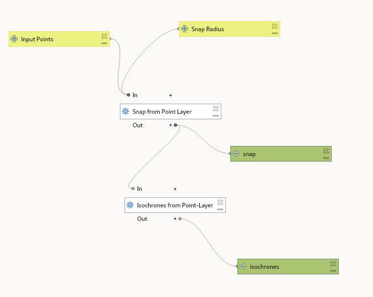
Fig. 55 The model structure#